


Unorg. Terr. No. 2 Prec. 1, Lake County, Minnesota
About
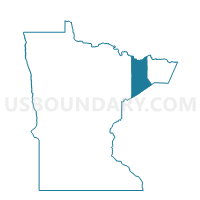
Outline

Summary
| Unique Area Identifier | 602869 |
| Name | Unorg. Terr. No. 2 Prec. 1 |
| County | Lake County |
| State | Minnesota |
| Area (square miles) | 2.17 |
| Land Area (square miles) | 2.17 |
| Water Area (square miles) | 0.00 |
| % of Land Area | 100.00 |
| % of Water Area | 0.00 |
| Latitude of the Internal Point | 46.96433430 |
| Longtitude of the Internal Point | -91.78637440 |
Maps


Graphs
Select a template below for downloading or customizing gragh for Unorg. Terr. No. 2 Prec. 1, Lake County, Minnesota


Neighbors
Neighoring Voting District (by Name) Neighboring Voting District on the Map
- Duluth Twp. Voting District, St. Louis County, MN
- Unorg. Terr. No. 2 Prec. 2, Lake County, MN
- Unorg. Terr. No. 2 Prec. 3, Lake County, MN
- Voting Districts not defined, Lake County, MN
Top 10 Neighboring County Subdivision (by Population) Neighboring County Subdivision on the Map
- Lake No. 2 UT, Lake County, MN (2,094)
- Duluth township, St. Louis County, MN (1,941)
- County subdivisions not defined, Lake County, MN (0)